| [ Login ]/[ Register ] |
 Search ::
  My Data Basket ::
  Favorite/My Favorite :: Recent Changes :: :: Login Save in Data Basket ]
| Caption:长宁村北侧敌台 Photo Time:2007-05-27 09:55:48 Photo Contributor:山西省文物局 [Open in New Window] |
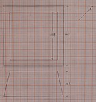
| Caption:长宁村北侧敌台 Photo Contributor:山西省文物局 [Open in New Window] |
| Caption:长宁村北侧敌台 Photo Time:2007-05-27 09:55:48 Photo Contributor:山西省文物局 [Open in New Window] |

| Caption:长宁村北侧敌台 Photo Contributor:山西省文物局 [Open in New Window] |