| [ Login ]/[ Register ] |
 Search ::
  My Data Basket ::
  Favorite/My Favorite :: Recent Changes :: :: Login Save in Data Basket ]
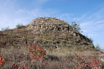
| Caption:张家沟村烽火台 Photo Time:2008-10-19 09:48:58 Photo Contributor:陕西省文物局 [Open in New Window] |
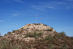
| Caption:张家沟村烽火台 Photo Time:2008-10-19 09:53:48 Photo Contributor:陕西省文物局 [Open in New Window] |
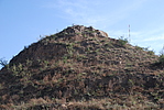
| Caption:张家沟村烽火台 Photo Time:2008-10-19 09:56:29 Photo Contributor:陕西省文物局 [Open in New Window] |
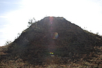
| Caption:张家沟村烽火台 Photo Time:2008-10-19 09:58:42 Photo Contributor:陕西省文物局 [Open in New Window] |