| [ Login ]/[ Register ] |
 Search ::
  My Data Basket ::
  Favorite/My Favorite :: Recent Changes :: :: Login Save in Data Basket ]
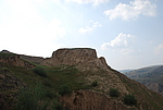
| Caption:张天赐长城1段 Photo Time:2007-08-31 15:16:09 Photo Contributor:陕西省文物局 [Open in New Window] |
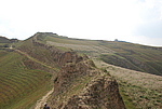
| Caption:张天赐长城1段 Photo Time:2007-08-31 15:46:14 Photo Contributor:陕西省文物局 [Open in New Window] |
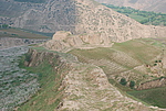
| Caption:张天赐长城1段 Photo Time:2007-08-31 15:51:41 Photo Contributor:陕西省文物局 [Open in New Window] |
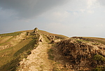
| Caption:张天赐长城1段 Photo Time:2007-08-31 16:52:43 Photo Contributor:陕西省文物局 [Open in New Window] |