| [ Login ]/[ Register ] |
 Search ::
  My Data Basket ::
  Favorite/My Favorite :: Recent Changes :: :: Login Save in Data Basket ]
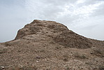
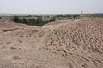
| Caption:三趟墩7号烽火台 Photo Time:2007-06-03 16:12:23 Photo Contributor:宁夏回族自治区文物局 [Open in New Window] |
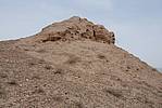
| Caption:三趟墩7号烽火台 Photo Contributor:宁夏回族自治区文物局 [Open in New Window] |
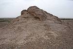
| Caption:三趟墩7号烽火台 Photo Contributor:宁夏回族自治区文物局 [Open in New Window] |
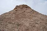
| Caption:三趟墩7号烽火台 Photo Contributor:宁夏回族自治区文物局 [Open in New Window] |
| Caption:三趟墩7号烽火台 Photo Contributor:宁夏回族自治区文物局 [Open in New Window] |